Climate-adaptative Program Management for Provincial Highway 18-Functional climate-proof strategies for the resilient and scenic highway
Provincial Highway 18, also known as the Alishan Highway, is a vital scenic route in Taiwan connecting to the Alishan National Scenic Area. The Wuwantsai section characterized by steep slopes and hairpin turns has historically been prone to severe landslides triggered by heavy rainstorms and typhoons. A major disaster occurred in June 2003, collapsing 200 meters of embankment and washing away 6 hectares of slopes. Monitoring data collected since 2000 indicated significant surface movement correlated with precipitation during the rainstorms and typhoons
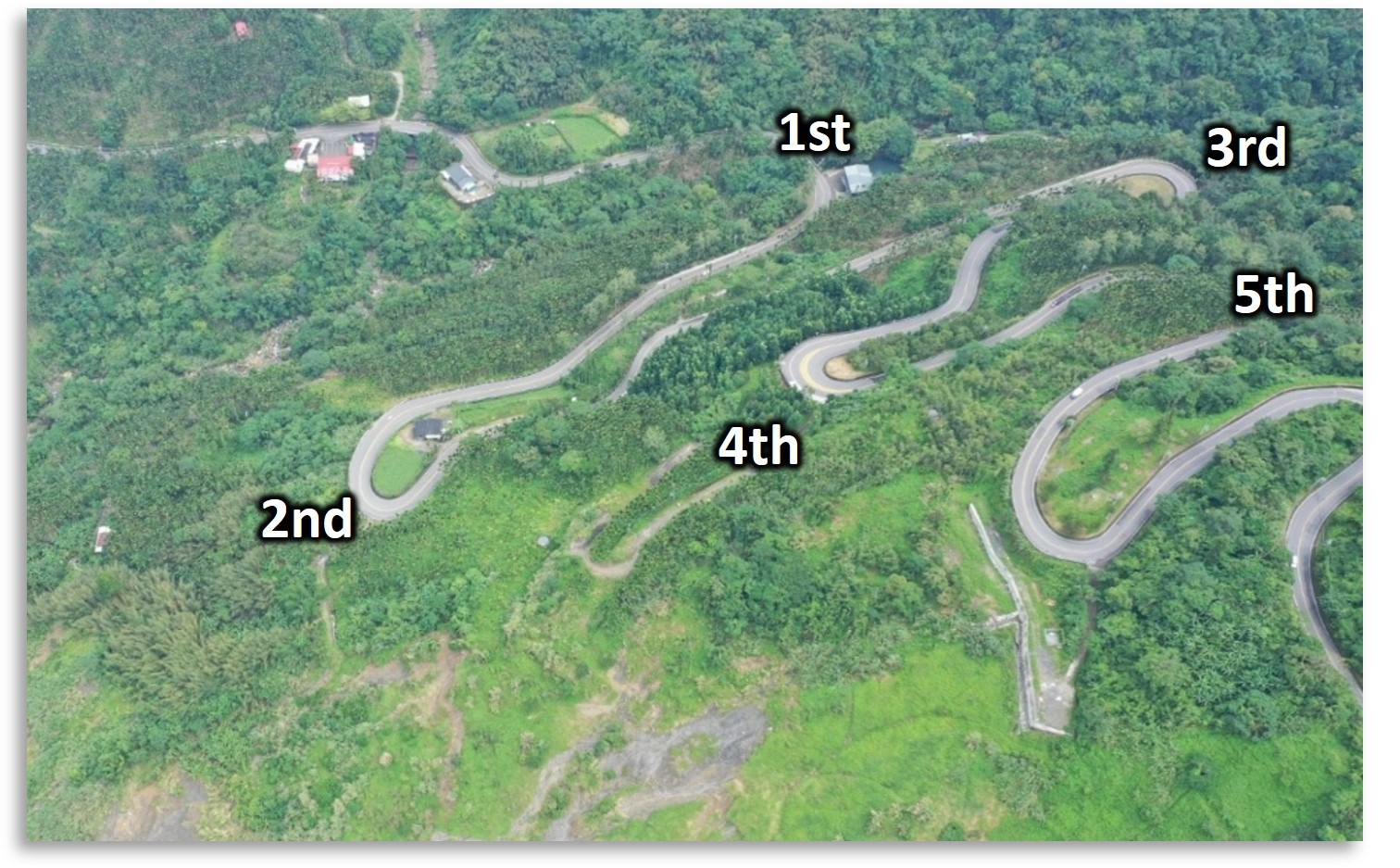
Picture1 Wuwantsai (Provincial Highway 18 markers 42-45K)
A climate-adaptative program management with functional strategies, led by the Yunlin-Chiayi-Tainan Region Branch Office of the Highway Bureau (THB) and collaborated by the Land Engineering Consultants (LEC), and the Department of Biological Resources of National Chiayi University (NCYU), spearheaded a multi-phase strategy spanning from 2003 to 2025. Initial investigations (2003-2006) involved rerouting the roadway with new hairpin turns to bypass the major collapse zone and avoid headward erosion, alongside detailed geological and hydrological analyses. These analyses revealed geological vulnerabilities, including the presence of the Tatou and Kungtien faults, as well as fractured sandstone and shale in the landslide zone. Hydrological studies confirmed continuous headward erosion as a major collapse cause and showed underground water tables rising significantly—up to 26 meters—after typhoons.
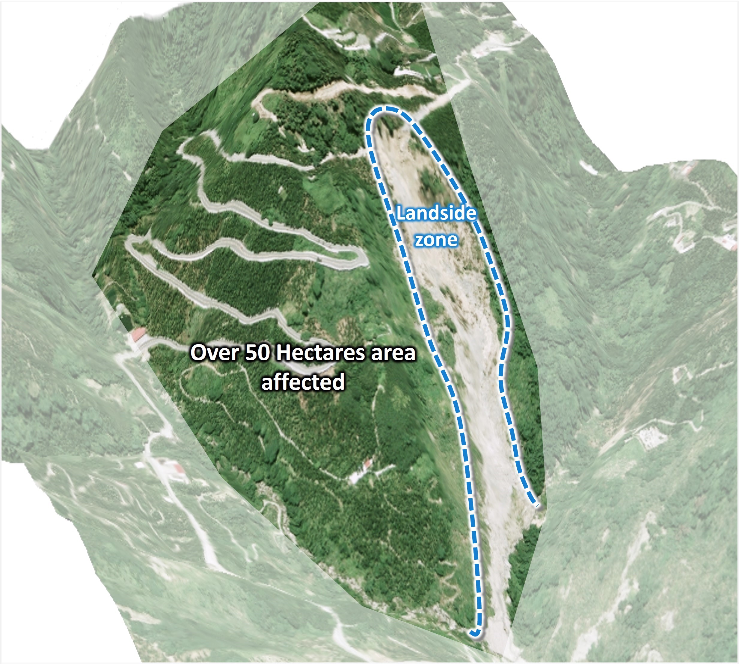
Picture2 Landside Zone & Influence Area
Based on these findings, comprehensive and functional climate-proof strategies were implemented over the subsequent decades. Effective water management was crucial, involving surface drainage networks like berms and cascade drains, alongside subsurface French drains to control runoff and groundwater. A key component was an extensive stormwater well system, comprising eight deep wells (4.5 meters in diameter and 45-52 meters deep) designed to reduce pore pressure. An interconnected system of four of these wells was later constructed to collect and drain excess groundwater even faster. Concurrently, slopes and embankments were reinforced using prestressed anchors, piling systems, check dams with reinforced earth walls at the landslide toe, and sustainable erosion protection techniques like gabion walls.

Picture3 Stormwate Well & Horizontal French Drains
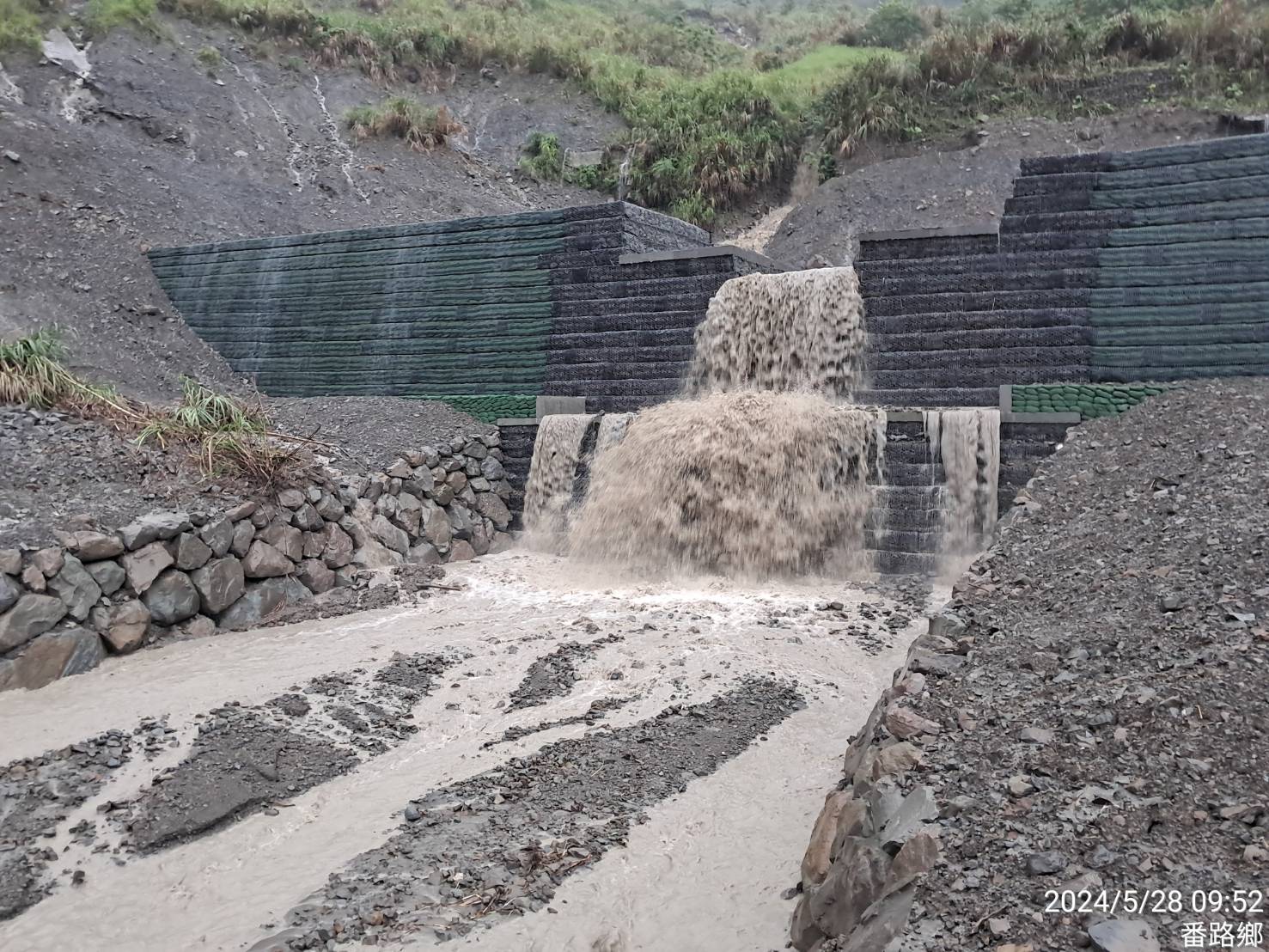
Picture4 Check Dam System With Reinforced Earth Walls
The outcomes through 2026 have been highly successful. The stormwater well system proved exceptionally capable; the W-6 well alone collected a record 2,797,720 liters of water in a 24-hour period. The overall groundwater table was reduced to 60% after the first four wells were constructed, and it further declined to 30% upon the completion of the second well system. Consequently, annual surface movement drastically decreased from 11-20 cm in 2003 to less than 2 cm. Even during a severe typhoon in 2024 that brought 1,475mm of daily precipitation, surface movement was nearly negligible, and the road section suffered no landslides.
Beyond structural stability, a multi-year ecological survey (2023-2026) established a baseline for environmental restoration, confirming the recovery of native forests and sensitive species like fireflies and the Formosan rock macaque (Macaca cyclopis). This successful eco-system recovery has revived the highway's scenic reputation and boosted local tourism. Finally, the program's efficiency is reflected in its economic impact: the proportion of the annual maintenance budget allocated to the Wuwantsai section dropped significantly, falling from 15% in 2014 to just 3% in 2026.